
Geographic Information Systems, or GIS, might seem like high technology, but its benefits are human. That’s because when organizations can visualize geographic data, it makes everyone’s job easier.
The basic benefits are easy enough to catalog. GIS enables organizations to build a database of geographically referenced information and then analyze that information. It is visual, electronic and easy for most people to understand.
These kinds of benefits, however, are limited to specific use-cases for GIS for individuals. What happens on an organizational level when GIS technologies are adopted? How does it make people’s lives easier?
There are lots of answers to that question, but we want to highlight three.
GIS gives you real time accessible information.
In the not-so-distant past, if you worked for a water utility, chances are you kept your records in a big coffee-stained notebook that you filled up by hand year after year.
Need to look up a specific hydrant? Need to figure out which water lines might need to be replaced? Consult the notebook.
Using the notebook came with plenty of drawbacks. First, someone had to go out and collect the data in the field. Then, you had to catalog it all by hand. Finally, when you were ready to reference it later, you had to take the time to look it up and try to make sense of it all. If you had to compare two sets of data, you were flipping around to at least two different tables.
While this manual process might have its own nostalgic allure, it pales in comparison to an electronic GIS system, which allows you to digitally access all the info you need in real time. GIS is superior for a few reasons.
First, it can help to save time so you can make decisions more efficiently. That is not just because it is easier to look things up. It is because the data you look up is so much richer.
Let’s go back to the example of water lines. Imagine you are tasked with maintaining all of your municipality’s water lines and you want to be proactive and intelligent about where you start.
Without a GIS system, you are stuck poring through a notebook, trying to identify where the municipality had issues in the past.
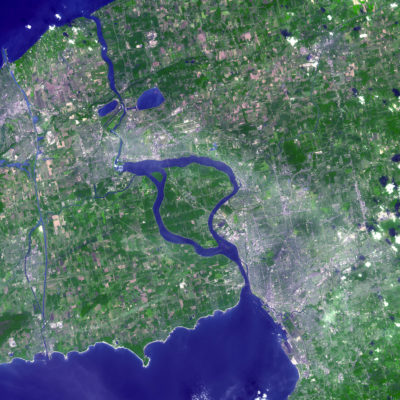
With a GIS system, all you need to do is type in your search criteria and voila—every water line that had a break in the past five years pops up. Since the people in the field can update data on the spot using mobile devices, you know this information is as up-to-date as possible. Additionally, those water lines are displayed on a map so you can easily identify clusters of problems and schedule maintenance accordingly.
This example illustrates how the real time, easily accessible data made visual by a GIS system enables workers at every level of an organization to make smarter, more informed decisions in a more efficient way, and everyone benefits because of it.
GIS can reduce your reliance on institutional memory.
We already talked about the drawbacks inherent to a municipality keeping records solely in notebooks. Sometimes, though, the most crucial information needed for running an organization is not written down on paper; it is locked inside the employees’ heads.
Institutional memory is equal parts blessing and liability when you are running a municipality. On the plus side, it means your most vital employees have gotten so good at their jobs that they have internalized all the crucial wisdom necessary to be really, truly effective.
On the contrary, these employees will eventually leave or retire, taking all their hard-earned knowledge with them. There is no silver bullet for this problem, but in its own particular way, employing GIS technology can help.
Consider the problem in more detail. The most valuable information captured by institutional memory is complex. Any new employee can learn and re-learn basic facts. True wisdom, however, comes from understanding the relationships between this information and the processes that surround it. That is much harder to capture.
GIS, fortunately, is all about capturing and communicating relationships between entities—specifically entities matched to a location. That quality makes GIS well-suited for capturing and preserving certain types of institutional memory.
Ron Ashkenas, writing for the Harvard Business Review, identifies three key strategies for preserving institutional memory. The first two—“build an explicit strategy” and “identify a few key things that you want every member of your team to know”—are good tips for any organization.
The third, “use technology,” describes GIS’s role perfectly.
“Use technology,” Ashkenas writes, “to create a process by which your team continually captures and curates institutional knowledge — to make it a living and evolving body of useful information that is accessible to people as they come into the organization.”
GIS does just that.
By using GIS in day-to-day operations, you are automatically logging new information; the database is always evolving. In addition to the previously mentioned benefits GIS provides, it also enables organizations to easily generate a database that newcomers can access, study and understand. That way, when your oldest and wisest employees walk out the door, you can carry on more effectively.
GIS encourages meaningful transparency.
Transparency is vital for running an effective, honest and accountable organization, but is more difficult than you might think. That is because true transparency is about more than just making information available to people involved with a project. It is about making sure they understand the information.
GIS is an effective tool of transparency because it makes understanding so easy and intuitive. By visualizing data and enabling people to analyze and 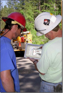 manipulate it on their own, GIS lays the foundation for more nuanced and informed conclusions.
Internal to an organization, this type of transparency often takes the form of “seeing the big picture.”
Say you are an employee at a municipality working on a big infrastructure project. You are working with a team of internal decision makers as well as a team of external engineers, and you need to make sure everyone can effectively collaborate.
You could call constant meetings, enforce hard deadlines and require everyone involved to regularly report on what they are doing. While these are not bad ideas, they can easily become inefficient because they require people to drop what they are doing and expend effort translating their knowledge for the team at large.
GIS can help to reduce some of this stress. When everyone on the team is using the same tool to interpret the same data in real time, and they can interpret it visually, it is much easier for all involved to grasp the big picture.
Similarly, public-facing GIS tools can help ordinary citizens understand how their tax dollars are being spent.
Say you are kicking off that same big infrastructure project. To publicize it, someone from the local government holds a press conference describing exactly what they hope to achieve. An article goes out in the local paper detailing the cost to the public. An ordinary citizen sees all this, knows their taxes are going toward all sorts of local improvements and then what? At best, they probably get stuck in slow traffic because they have to drive around a work crew; at worst, they witness no visible improvement at all.
Engaged citizens get miffed, and all of a sudden your phones are ringing off the hook? Where is all this money going? Why is there a work crew clogging up Main Street? Inquiring minds want to know, but trying to explain to them in the heat of the moment might not do much good.
In this case, a public-facing GIS application on your municipality’s website could answer these questions for you in a much more comprehensive fashion. Citizens can browse, view and analyze data about the project on their own, getting a sense for the full scope and progress of what you are doing.
You might still get a few angry phone calls here and there, but the transparency afforded by GIS could help cut those calls significantly.
All in all, GIS makes complex information more accessible and easier to understand.
When it is easier for people to grasp the big picture, get a handle on the relationship between disparate pieces of information and make informed decisions, their lives (and their jobs) become easier. That is exactly what GIS does. Used properly, it strengthens the understanding of everyone that a project touches, from the workers in the field to the public.
Written by: Heather Lewis, GIS Analyst